1. Fernside | Royal Borough of Fernside
 |
| Fernside |
Fernside is the oldest and largest borough of Gristol City, located northeast from central Gristol, on the left bank of River Argon, upstream the fall of Grist. It occupies 75 sq.km. and has 47.000 inhabitants. Western part occupies the terrace of Argon Valley, while in the eastern side is a densely-forested Fernside - Sapiehall creek. In the southern side is Grist Valley, few large hills and creeks and the Mountain Park.
 |
| Fernside - Church of St. Peter and Paul's |
Fernside is mostly a residential area, but is known for many historical buildings.
Notable buildings
- Sollow Palace
- Sapieha Palace
- National M.K. Charlett School of Arts
- St. Peter and Paul's Church
 |
| Romsey |
2. Romsey | Royal Borough of Fernside
Romsey (or Romse) is a northeastern borough of Gristol, near Pinefalls Dr. It has a post office, pension with a chapel and Lake Romse in the east. Currently, 196 inhabitants reside in Romsey.
3. Highwood | Royal Borough of Fernside
Highwood is situated on the left bank of r. Argon, near Road 102. It has a post office, a shop and a market. In the northern side of Highwood, new residential apt. block will be constructed.
4. Upper Ilchester | Royal Borough of Fernside
Upper Ilchester is situated in the northeastern side of Gristol, near Road 102.
5. Upper Erlands | Royal Borough of Erlands
Upper Erlands is located in southeastern side of Gristol, west from Erland Tunnel. Located in a forested territory. Has a railway station and Erland Memorial Museum.
6. Upper Ebbsfleet | Royal Borough of Fernside
Upper Ebbsfleet is located on the right bank of River Ebbsfleet, east from Lower Ebbsfleet.
7. Royston | Royal Borough of Cryton
Royston is located to northeast, on the right bank of River Argon, east from Cryton Eyre. Mostly consist of residential apartments and gardens.
8. Dukes | Outer Territory of Farminster Borough
Dukes is located to the northwest part of Gristol, north from Farminster. It is the southern part of Dukes Village.
9. Aldbourne | Royal Borough of Erlands
Aldbourne is located in the southwest, between Welldon Hamlets in the south and Gordon in the north, on the left bank of River Hamlets.
10. Framlingham | Royal Borough of Cryton
Framlingham is situated in the northeast, on the right bank of River Argon. It is a luxury borough with beautiful nature and mythological Framlingham Park. It is the closest borough to Park Europe. It is famous for Green lakes, situated in Cryton Regional Park. From 2011 m., Framlingham High School
11. Whitelea | Royal Borough of Cryton
 |
| Whitelea, Calvary St. |
Whitelea is situated to the north of central Gristol. It occupies 26 sq. km. It has Jamont Park, Gristol Whitelea High School and it's own Whitelea Radio. It is mostly a residential borough.
12. Banning | Outer Territory of Fernside Borough
Banning is situated northeast from central Gristol, near Leffen river, northwest from Laytton. It houses Banning cemetery and a historical Banning mound.
13. Hartlepool | Outer Territory of Notcham Borough
Hartlepool is located near the city boundaries, west from Road A15 (Gristol - Lida). It is the northern part of Hartlepool village.
14. Barkers | Outer Territory of Notcham Borough
Barkers are located in the south, southeast from Salteby. It is the northern part of Barkers village (the southern part is located behind the railway).
15. Boews | Royal Borough of Dewlington
Boews is situated south from central Gristol. The eastern side is an isolated steading.
16. Bellmount | Royal Borough of Dewlington
 |
| Bellmount Falls |
Bellmount is situated east from Central Gristol, in Penmon Regional Park. It has a luxury park, a stud farm and school and many luxury motels. A 6km walkway leads to Sapiehall, Grist flows in the south.
17. Ashingdon | Royal Borough of Cryton
Ashingdon is situated to the northeast, on the right bank of River Argon, south from Park Europe.
18. Clifford | Royal Borough of Sotswich

Clifford is located in the very northwest, near Sotswich. It houses argonomy school, Clifford high school, elementary school, post, gardens and Clifford Mansion, park and cemetery. Currently 1,830 inhabitants are living in Clifford.
19. Herford | Royal Borough of Nottingam
Herford is located west from Central Gristol, near Notting and Nottingam boroughs. Situated on the right bank of r. Argon, has a large Herford Forest. Herford is often confused with Notting, which is northwest from Herford. There is the old Herford Cemetery in Notting. It is mainly an apartment block borough.
20. Hitchin | Royal Borough of Notcham
Hitchin is located south from Central Gristol, eastwards to Notcham. In the south is Hitchin Park, in the north is railway Bravil - Gristol
21. Central Gristol | Royal Borough of Newtown
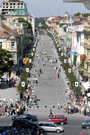 |
| East side of Clavering Blvd. |
Central Gristol is the central part of the capital, housing many historically and politically important, such as the Senate of Westerlands, M. Martell Royal Library, J. Clavering Blvd.
It is located west from Old Town, on the left bank of r. Argon, near the bend.
22. Stamford | Royal Borough of Erlands
Stamford is located in the southwest, 4 km to the south from Welldon Hamlets.
23. Wenlock | Royal Borough of Notcham
Wenlock is situated west from road A15 and to the north from Hartlepool.
24. Stretton | Royal Borough of Erlands
Stretton is located southwest, 3 km southeast from Welldon Hamlets, on the right bank of r. Hamlet
25. Great Swans | Royal Borough of Cryton
Great Swans are situated to the north, southwest from Swans Lake, east from road A14.
26. Great Wickers | Royal Borough of New Grist
Great Wickers (or just Wickers) are situated east, south from New Grist. It was the northwestern part of Grand Wickers village.
27. Great Beans | Royal Borough of Fernside
Great Beans are located northeast from Central Gristol, eastwards Fernside. It currently has 206 inhabitants.
28. Hatfield | Royal Borough of Notcham
Hatfield is located south from Central Gristol, near Elton Drive, west from Claymore. It houses a stadium.
29. Chirbury | Royal Borough of Erlands
Chirbury is located southwest from Central Gristol, 1 km southwards from Welldon Hamlets.
30. Heverfields | Royal Borough of Casterly
Heverfields are situated in the western side, southwest from Casterly, on the southwest side of Purlack Lake.
31. Heverfields | Royal Borough of Cryton
Heverfield is located in the northeast, northwest from Cryton Mews, near Mews stream.
32. Bayswater | Royal Borough of Fernside
 |
| Bayswater St. | Bayswater |
Bayswater is situated in the northeast, near Fernside, 7 km from central Gristol. Bayseere river flows through the district, there lies Bayswater Geomorphologic Reserve. It houses a jewelry factory, shop, library, elementary school, kindergarten and a pharmacy. South from Bayswater is a garden territory. It is one of the highest places in Gristol (average altitude 170m).
33. Farminster | Royal Borough of Farminster.
 |
| P. Calhoun st. |
Farminster is a major residential district to the north near Road A2. It houses an Education Center for Blind and Weak-eyed People.
34. Hastings | Royal Borough of Fernside
Hastings is located southeast from Bayswater. It is the western side of Hastings village, connected to the town.
35. Weighton | Royal Borough of Erlands
 |
| Weighton Industrial |
Weighton is situated southwest from central Gristol, north from motorway A1. It houses the largest market in Westerlands, Weighton Business Park, as well as a sand depository and a power plant.
36. Penmon | Royal Borough of Grantbury
Penmon is located west from Grantbury. It is the eastern side of Penmon village.
37. Lincoln | Royal Borough of Casterly
Lincoln is located south from Casterly and west from Cannertown.
38. Elm | Royal Borough of Erlands
Elm is located southwest from central Gristol
39. Benfleet | Royal Borough of Erlands
Benfleet is a linear settlement located near Timbervale. It is one of few linear settlements in Westerlands. In 1985 it had 340 inhabitants.
40. Startford | Royal Borough of New Grist
Startford is located south from Upper Grist, near road 101. It is a district of residential buildings.
41. Pink Gardens | Royal Borough of Fernside
Pink Gardens are situated northeast, north from Banning, near r. Leffen. Residential district.
42. Yankee Town | Royal Borough of Houndslow
Yankee Town is situated northwest from Lower Erlands, on the left bank of r. Argon.
43. Jerusalem | Royal Borough of Cryton
 |
| Calvary St. Cross Church | Jerusalem |
Jerusalem is situated north from central Gristol and started to build around Whitelea and Cryton Regional Park. It houses Calvary St. Cross Church and Gristol Jerusalem High School, as well as a statue park.
44. Runnymede | Royal Borough of Erlands
 |
| Power Plant in Runnymede |
Runnymede is situated west from central Gristol, on the left bank of r. Argon, near Weighton. It houses a large industrial territory with a heat power plant. It had 339 inhabitants in 1959.
46. Blackdrive | Royal Borough of New Grist
Blackdrive is situated in the southeast, 3 km to the northeast from Neutton, near road 101. A railway passes in the east.
47. Harrowbath | Royal Borrow of Harrowbath
 |
| Harrowbath Central |
Harrowbath is a major district in the northwest. It houses more than 289 apartment blocks and a cemetery. A majority of the district was built in late 20th century. It is mostly a residential district.
48. Croston | Royal Borough of Norwalk
Croston is situated to the southeast from Norwalk. It was abandoned in 2001 census.
49. Caerleon | Royal Borough of Fernside
 |
| Caerleon Mansion Gardens |
Caerleon is located east from Bayswater, near Leffen river. Eastern side of the settlement is a district. It houses an old mansion (dating back to XVI century, Caerleon Mansion) with park and ponds, Gristol University Botanical Garden. Mansion also had a restored stables, windmill, palace buildings and a cemetery.
50. Mountains | Royal Borough of Fernside
Mountains are located northeast from central Gristol, southwest from Bayswater. It consists mostly of residential buildings.
51. Eton | Royal Borough of New Grist
Eton is situated east from Dews, near road 101. Residential district
52. Calvary | Royal Borough of Cryton
 |
| Calvary Chapel |
Calvary is located south from Jerusalem, on the right bank of river Argon, in Cryton Regional Park. It houses Calvary St. Cross Founding Church, Cryton Calvary, Gristol St. Joseph Priest Seminary. Cedron river flows nearby. Cryton Calvary is a Cross way, established in 1662-1669 and unique by his stop count - 22 brick chapels, 7 wooden gates and a wooden bridge - a chapel and late baroque St. Cross Founding Church upon a hill.
53. Cannertown | Royal Borough of Cannertown

Cannertown is situated to the west, on the right bank of river Argon, west from Courtsham and north from Nottingham. Cannertown houses the tallest building in Westerlands - Gristol TV Tower. It also houses NSIF administrative building, Science and thesaurus press insitution, a clinic, 3 gymnasiums, 2 high schools, main and music schools, 10 kindergartens, handicapped children education center, firemen rescue education center. It is dominated by apartment blocks and the Cannertown Reserve, Tale Park. Cannertown is located between Tolson river valley and Argon slope. Cannertown Landscape Reserve was established in 150ha territory. Tale Park is full of wooden fairy-tale character statues. Gristol TV Tower has a memorial for 1991 January 13th events.
54. Potters | Royal Borough of Dews
Potters are situated east from road A15.
55. Brinkburn | Royal Borough of Erlands
Brinkburn is located west from central Gristol, on the right bank of r. Hamlets. southeast from Wellden Hamlets.
56. Stumpton | Royal Borough of Erlands
Stumpton is located south from Lockett. Consists mostly of residential gardens.
57. Burnell | Royal Borough of Notcham
Burnell is situated north from railway and west from road A15. Part of Burnell Steading.
58. Camelford | Royal Borough of Notcham
 |
| Sculpt and Staining Center |
Camelford is located south from central. It houses many industrial companies and Gristol Charlotte Intl. Airport. It houses the biggest gypsy ghetto in Westerlands as well as Romany Community Centre.
59. Rotherham | Royal Borough of Notcham
Rotherham is located east from Lockett.
60. Wroxeter Gardens | Royal Borough of Cryton
Wroxeter is situated northeast from central, on the right bank of Argon. West from Crosses, on the east coast of Sounding Lake. Consists of residential gardens.
61. Brackley | Royal Borough of Cryton
Brackley is located east, near Turnip river
62. Salford | Royal Borough of Casterly
Salford is located west, west from Casterly. Former north side of Salford village.
63. Crosses | Royal Borough of Cryton
Crosses are situated northwest. Near them are Lesser Crosses. It had 169 inhabitants in 1979.
64. Alberbuty | Royal Borough of Erlands
Alberbuty is located southwest, on the left bank of river Hamlets, north from Bracken Hamlets.
65. Warkworth | Royal Borough of Dews
Warkworth is located south of central Gristol.
66. Cambridge | Royal Borough of Notcham
Cambridge is located east from Lockett, on the other side of the railway.
67. Wolverhampton | Royal Borough of New Grist
Wolverhampton is located in the east, west from New Grist, on the right bank of river Grist. To the north lies Badgerdale Forest.
68. Nottingham | Royal Borough of Nottingham

Nottingham is situated to the west, on the right bank of river Argon. It currently has 32,000 inhabitants and many companies residing. It houses Nottingham clinic, St. John Bosque Parish, Litexpo Convention Centre, Tale Park, Ambulance University Hospital, Nottingham Swimming Centre. In the south Argon makes a bend, where Buck Forest, old Buck Cemetery and Nottingham Bridge resides. District lies in a mountainous territory and most of it still has many of the natural forest. Traffic congestion is very low and the street maze is rare, but connection for pedestrians is very comfortable.
69. Notting | Royal Borough of Nottingham
Notting is located west, on the right bank of Argon. To the east lies Buck Forest, to the southeast is Buck. In the west are old Buck Cemetery.
70. Lionsare | Royal Boroughs of New Grist and Dews
Lionsare is situated in the east, east from Bellmount, on the right bank of Grist.
71. Willowhill | Royal Borough of Notcham
Willowhill is located to the east from Notcham and south from Dews. Karaite and tartar cemetery. Houses ski-center "Winter Track"
72. Willons Gardens | Royal Borough of Fernside
Willons is situated northeast, on the left bank of Argon, near road 102. In consists of residential gardens.
73. Ludinaw | Royal Borough of Erlands
Ludinaw is situated to the southeast, east from Wellden Hamlets. It had 576 inhabitants in 1959.
74. Corpond | Royal Borough of Newtown

Corpond is located in central Gristol, west from Old Town, on the left bank of Argon. To the east were the old channels of Gristane and Sanhorn Woods. It is also known as tartar luns or tartary. Houses Corpond Square, Corpond Prison and Gristol Corpond Prison St. Nicholas Church.
75. Layne Road | Royal Borough of Dews
Layne Road is located in the south, on the east side of Road A15, northbound Blackfriars Drive.
76. Sleaford | Royal Boroughs of Dews and Fernside
Sleaford is located to the east, north from Bellmount and south from Fernside Cemetery, at the start of Road 103.
77. Marquis Gardens | Royal Borough of Dews
 |
| Marquis Mansion Park |
Marquis Gardens is situated southeast, on the left bank of Grist, east from Dews. It houses Marquis Mansion and Park and A. Pushkin museum. In the Marquis Oakwoods was the first summer camp of Westerland Dukes.
78. Holbeach | Royal Borough of Erlands
Holbeach is located southwest, east from Bracken Hamlets, en route to Timbervale.
79. Lesser Swans | Royal Borough of Cryton
Lesser Swans are located northeast, south from Grand Swans. It had 211 inhabitants in 1959.
80. Lesser Beans | Royal Borough of Fernside
Lesser Beans are situated northeast, southeast from Great Beans. It had 75 inhabitants in 1959.
81. Edington | Royal Borough of Fernside
Edington is located to the northeast. It is the southern side of Edington village.
82. Metropolis | Royal Borough of Erlands.
Metropolis was a former steading, now a district located 3 km southeast from Welldon Hamlets.
83. Ryde | Royal Borough of Notcham
Ryde is situated south, southeast from Lockett, southbound from Cambridge.
84. Millwokee Gardens | Royal Borough of Fernside
Millwokee Gardens are located northeast, north from Sapiehall. It contains residential gardens.
85. Michael-by-Argon | Royal Borough of Fernside
Michael-by-Argon is situated to the northeast, near Road 102.
86. Bracken Hamlets | Royal Borough of Erlands
Bracken Hamlets is located to the west, 1 km to the north from Welldon Hamlets. The river has been dammed and Bracken Hamlet Pond has been created.
87. Newgarden | Royal Borough of Erlands
Newgarden is located southwest, 3 km southeast from Welldon Hamlets, southbound Brickburn, in front of Metropolis.
88. Newgarden | Royal Borough of Cryton
.JPG) |
| Newgarden (Cryton) |
Newgarden is located north, southbound Whitelea.
89. Newtown | Royal Borough of Newtown
 |
| Helios City Tower, Newtown |
Newtown is a major borough in central Gristol, west from Railway Station. It borders with Houndslow, Old Town, Notcham and with river Argon. It houses many historical buildings, as well as Helios City Tower.
90. New Ers | Royal Borough of Cryton
New Ers is located to the north. To the north lies Redmansion Forest, 3 km away is Park Europe, to the southern side is Sounding Lake, one of 6 Green Lakes. It had 44 inhabitants in 1959.
91. New Cryton | Royal Borough of Cryton
New Cryton is located to the northeast from Cryton. It houses a power plant and kindergarten. It had 300 inhabitants in 1985.
92. Notcham | Royal Borough of Notcham
 |
| Old Believer Church |
Notcham is located to the south, separated from Old Town and Newtown by a railway. It houses an eldership, clinic, Old Believer Church, karaite and tartar cemeteries.
93. Newast | Royal Borough of Casterly
Newast is situated to the west, west from Platan Woods. Formed part of Newast Steading.
94. New Grist | Royal Borough of New Grist
 |
| New Grist from Victory st. |
New Grist, former town, is east from central Gristol, en route to Ryde. It is the last stop of trains from Gristol. It houses St. Casimer Church, Holy Virgin Mary Queen of Peace Church, Gristol St. Paul and Peter's the Disciples Church, New Grist Clinic, National Gristol Psychiatry Hospital, several libraries, a bookstore, Roccan Cemetery, stadium, Goodness Park, National Court Medical Building, Gristol City 4th District Court.
95. Newbury Gardens | Royal Borough of New Grist
Newbury is situated in the southeast, near road A3. It contains of residential gardens.
96. Norwich | Royal Borough of Hindon
Norwich is located to the west, near Hindon. The district has 58 inhabitants (2001 census)
97. Goaters | Royal Borough of Cryton
Goaters are located to the east from New Cryton and to the north from Cryton Mews, on the right bank of Argon. It houses a shop, two bus stops.
98. Coggeshaf | Royal Borough of Casterly
Coggeshaf is situated to the west, west from Casterly, on the east coast of Gilon Lake
99. Nearpines | Royal Borough of Erlands
Nearpines are located to the west.
100. Preston Gardens | Royal Borough of Cryton
Preston is located to the northwest, north from Sounding Lake. It contains residential gardens.
101. Amersham | Royal Borough of Notcham
Amersham is situated to the south, west from road A15, northbound Beanons.
102. Riverside | The Old Town of Gristol
Riverside is located to the southeast from Old Town, in central Gristol, in front of Southend.
103. Beaulieu | Royal Borough of Farminster
Beaulieu are located in the northwest, northbound to Farminster, on the eastern side of Road A2
104. Beaulieu | Royal Borough of Grantbury
Beaulieu is located to the northwest, between Grantbury and Tarandy, on the western side of Road A2
105. Grantbury | Royal Borough of Grantbury
 |
| S. Lawrens st., Grantbury |
Grantbury is a major borough situated to the northwest. It mostly consists of apartment blocks.
106. Furnace Gardens | Royal Borough of Fernside
Furnace is located to the northwest, on the left bank of Argon, southbound Willows, near Road 102. Consists of residential gardens.
107. Casterly | Royal Borough of Casterly
Casterly is a major borough in the west, on the right bank of Argon. It houses Casterly Mansion Ruins, peony, oficin, watermill and two mounds. It mostly consists of residential houses.
108. Platans | Royal Borough of Casterly
Platans are situated in the west, west from Casterly.
109. Masonry | Royal Borough of Casterly
Masonry is located in the west, north from Lake Gilon.
110. Brandon | Royal Borough of Cryton
Brandon is situated in the north, near the city borders and Road A14.
111. Beans | Royal Borough of Notcham
Beans is situated in the south, east from Lockett on the side of Road A15.
112. Thorton | Royal Borough of Fernside
Thorton is located to the northeast, north from Milwokee Gardens.
113. Brackley | Royal Borough of New Grist
 |
| Brackley Exposure from Bellmount side |
Brackley is located to the east, between Fernside and New Grist. It belongs to Arg Regional Park. Grist flows through Brackley and massive deep-carve pockets open here. The famous Bracket Exposure is located here, which is a geological monument. It is one of the highest ice-age exposures in Westerlands. A wonderful Gristol panorama opens here. It also has Brackley Mound, on it's bottom is a stone-age camp.
114. Tawton | Royal Borough of Notcham
Tawton is located to the south, west from Lockett.
115. Dews | Royal Borough of Dews
 |
| Dews Cemetery |
Dews is a major borough situated to the southeast. Dews are famous for their cemetery.
116. Boiam | Royal Borough of Dews
Boiam is located to the southeast, in Arg Regional Park. It houses beautiful erosion pocket fans and hills and the city panorama from Boiam Hill.
117. Crewkerne | Royal Borough of Houndslow
Crewkerne is located in the west, on the left bank of Argon, southbound Houndslow, near railway. It is a residential district.
118. Hawarden | Royal Borough of New Grist
 |
| Ruins of Hawarden Castle |
Hawarden is situated to the east, on the both banks of Grist. It belongs to Arg RP. It houses ruins of Hawarden Castle as well as Hawarden Cemetery.
119. Blackfriars Road | Royal Borough of Dews
Blackfriars Road is located to the southeast. It is on the eastern side of Road A15, leading to Blackfriars.
120. Ravenaire Gardens | Royal Borough of Cryton
Ravenaire is located to the northeast, on the right bank of Argon, 2 km to the south from Calin. It contains residential gardens.
121. Lockett | Royal Borough of Notcham
Lockett is situated to the south. It is split into 4 territories: Mellorators, Old, New and the Airport Territory. It houses Gristol Charlotte Intl. Airport. It had 2,800 inhabitants in 1989.
122. Islands | Royal Borough of Hindon
Islands is located to the west. It has 111 inhabitants (2001 census)
123. Salott | Royal Borough of Casterly
Salott is situated to the west, west from Casterly.
124. Masham | Royal Borough of Courtsham
Masham is located to the northwest, on the right bank of Argon, between Courtsham and Downtown Gristol.
125. Santary | Royal Borough of Cryton
Santary is situated to the north. It has one of the largest hospitals in Westerlands - Gristol University Santary Hospital)
126. Sapiehall | Royal Borough of Fernside
Sapiehall is located to the northeast. It belongs to ARP. It houses water collecting channel complex. Exploration travel paths lead to Badgerdale and Bellmount.
127. Sunnerdowns | Royal Borough of Fernside
 |
| Dorms in Sunnerdowns |
Sunnerdowns is located to the northeast. The district mostly consists of dorms.
128. Baldwin | Old Town
 |
| Baldwin Park |
Baldwin is located to the east from Old Town, in central Gristol, on the left bank of Grist. It mostly consists of Baldwin Park.
129. Wealdstone | Royal Borough of Cryton
Wealdstone is situated to the north, on the both sides of Road A14.
130. Pontony Gardens | Royal Borough of Casterly
Pontony is located between Casterly and Clifford. Mostly consists of residential gardens.
131. Sandstone | Royal Borough of Fernside
Sandstone is located to the northeast.
132. Hedon | Royal Borough of Cryton
Hedon is situated to the northeast, on the right bank of Argon. Houses Hedon Mound.
133. Cirencester | Royal Borough of New Grist
Cirencester is located to the east, on the left bank of Grist, southeast from New Grist. Houses Cirencester Cemetery and Greenmount Park.
134. Tarandy | Royal Borough of Grantbury
Tarandy is located to the northwest, south from Oaters, near motorway A3. Houses a clinic.
135. Buffalo Hill | Royal Borough of Newtown
 |
| Buffalo Hill |
Buffalo Hill is located in central Gristol, on the left side of Argon. It houses Warren Hill.
136. Welldon Hamlets | Royal Borough of Erlands
 |
| Welldon Hamlets Mansion |
Welldon Hamlets is situated to the southwest. In the east flows the river of Hamlets. Welldon Hamlets mostly consists of apartment blocks and rural streets. Houses Hamlet Railway Station, Welldon Hamlets Mansion, E. Andrais Park, Holy Virgin Mary Chapel, a high school and a post office. It currently has 4,000 (2001 census).
137. Trinity Place | Royal Borough of Cryton
 |
| Holy Trinity Church |
Trinity Place is located to the east from Whitelea and northwest from Brownchurch. It belongs to CRP. Houses Gristol Holy Trinity Church and monastery.
138. Combe | Royal Borough of New Grist
 |
| Combe Church |
Combe is located to the east, on the left bank of Grist, west from New Grist and southwards Brackley. Belongs to ARP. Houses an expansive pocket system and a famous road serpentine, Arg Christ the King and the Holy Child Jesus Church.
140. Tusculan | Royal Borough of Brownchurch
 |
| Tusculan Manor |
Tusculan are situated on the right bank of Argon, south from Brownchurch. Houses a large Tusculan manor and many apartment blocks.
141. Flint | Royal Borough of Cryton
Flint is located to the northeast, near Calin, northwards Pagubby.
142. Corner-by-Hamlets | Royal Borough of Erlands
Corner-by-Hamlets is located to the west, west from Welldon Hamlets and south from Timbervale.
143. Southend | The Old Town
 |
| Angel of Southend Column |
Southend is situated in central Gristol. It is a inner self-proclaimed republic, surrounded by a river, thus creating Southend peninsula. It mostly contains of apartments and homes of many artists.
144. Overwall | Royal Borough of Notcham
Overwall is located in the south, near Erland Woods.
145. Leiston | Royal Borough of Fernside
Leiston is situated to the east, near Ebbsfleet river, between Upper Ebbsfleet and Lower Ebbsfleet.
146. Bradford | Royal Borough of Erlands
Bradford is located to the west, between Welldon Hamlets and Timbervale.
147. Chalgrove | Royal Borough of Erlands
Chalgrove is located to the south, on the left bank of Hamlets.
148. Wallenham | Royal Borough of Fernside
 |
| Wallenham Beach |
Wallenham is situated to the northeast, on the left bank of Argon, in front of Cryton . Wallenham Bridge leads to Brownchurch.
149. Crows | Royal Borough of Casterly
Crows are located to the west, former steading west from Casterly.
150. Cryton | Royal Borough of Cryton
 |
| River Argon from Cryton side. |
Cryton is a major district north from central Gristol, on the right bank of Argon. It houses Cryton Regional Park, Cryton Mansion, palace, park, old pond system, forest, Science Palace, special school. An old paper factory remains. An ornithological path. Also houses Calvaries, Gristol Holy Trinity Church, monastery and recollection house. To the northwest is New Cryton.
151. Cryton Mews | Royal Borough of Cryton
Cryton Mews are located to the northeast, on the right bank of Argon. Northeast of Cryton and southeast from Grand Mews.
152. Business Triangle | Royal Borough of Newtown
Business Triangle is a district in central Gristol, on the left bank of Argon, near J.Jason st, A. Gopher st. and Houndslow Drive. It is a multifunctional business centre and the heart of Gristol's finances.
153. Gorgon | Royal Borough of Fernside
Gorgon is located to the northeast from Fernside, near Road 102, on the left bank of Argon.
154. Hulne | Royal Borough of Casterly
Hulne is located to the west, west of Casterly, on the western coast of Gilon Lake.
155. Houndslow | Royal Borough of Houndslow
 |
| Houndslow Hospital |
Houndslow is a major district in Gristol, situated in central Gristol, southwest from Newtown, on the left bank of Argon. Houses Gristol Divine Church, Holy Heart of Jesus Parish Church, Bend Park, power plant, furniture factory and Hounslow Hospital.
156. Gristol Old Town | The Old Town
~~~placeholder~~
157. Beaumaris | Royal Borough of Fernside
Beaumaris is located to the northeast, east from road 102, on the right bank of Ebbsfleet. The area mainly consists of residential gardens.
158. Bend Park | Royal Borough of Newtown

Bend Park is located west from central Gristol, on the left bank of Argon. Most of the territory is occupied by Bend Park. It also houses the Estrada Open Air Theatre, Gristol Botanical Gardens and Repnin Chapel.
159. Farindon | Royal Borough of Fernside
Farindon is situated to the east, on the left bank of Argon, north from Willows.
160. Highboughton | Royal Borough of Highboughton

Highboughton is a major borough, located to the northwest from central. It houses Gristol blessed George Maideron church, secondary school, Press Palace, Highboughton cemetery and the 2nd trolleybus station.
161. Bridport | Royal Borough of Fernside
Bridport is located to the northeast, near road 102.
162. Bridportaire | Royal Borough of Fernside
Bridportaire are situated to the northeast, near Bridport. It's a relatively quiet district, near the border with Gristol County, surrounded by forests. It is known for the Bridportaire polygon.
163. Visors | Royal Borough of Cryton
Visors are located to the north, west from Santary.
164. Marshshore | Royal Borough of Marshshore
Marshshore is a major borough, located to the west. It houses Marshshore Secondary School and a library. It currently has 1,600 inhabitants (2011 census)
165. Oakens | Royal Borough of Notcham
Oakens are located to the south.
166. Oakenstone | Royal Borough of Dews
Oakenstone is located to the southeast from Gristol Intl. Airport.
167. Gilling | Royal Borough of Gilling

Gilling is a major borough situated to the north from Central Gristol. It houses a clinic, cemetery. To the east there is the famous Gilling esker and Gristol's Acropolis Mall. East from them is Siemens Arena and Vichy aquapark. To the west, near the border with Highboughton, are the sport complexes "Tennis World and universal sports arena "Sportima". Near them - ice palace - Slowe Amusement Arena.